Since the Skinningrove tour there had always been a gap in the Cleveland Way not yet completed between near Boulby and Staithes, it was time to fill in the gap. Between the easternmost part of the Skinningrove to Mars and the westernmost part of the Runswick Bay to Staithes Tiggy Tours.
Parking just off the A174 here at Cowbar Lane, this route heads to the coast and the Cleveland Way. Heading west for a couple of miles along the clifftops to the Mars part of the the Skinningrove to Mars tour. Then about turn and head east back along the Cleveland Way to Cowbar, just over the Staithes Beck from Staithes.


Here’s Tiggy parked at the side of the lane, looks quiet doesn’t it…
It wasn’t. But there are always spaces, it’s a long road with plenty of parking to the side.
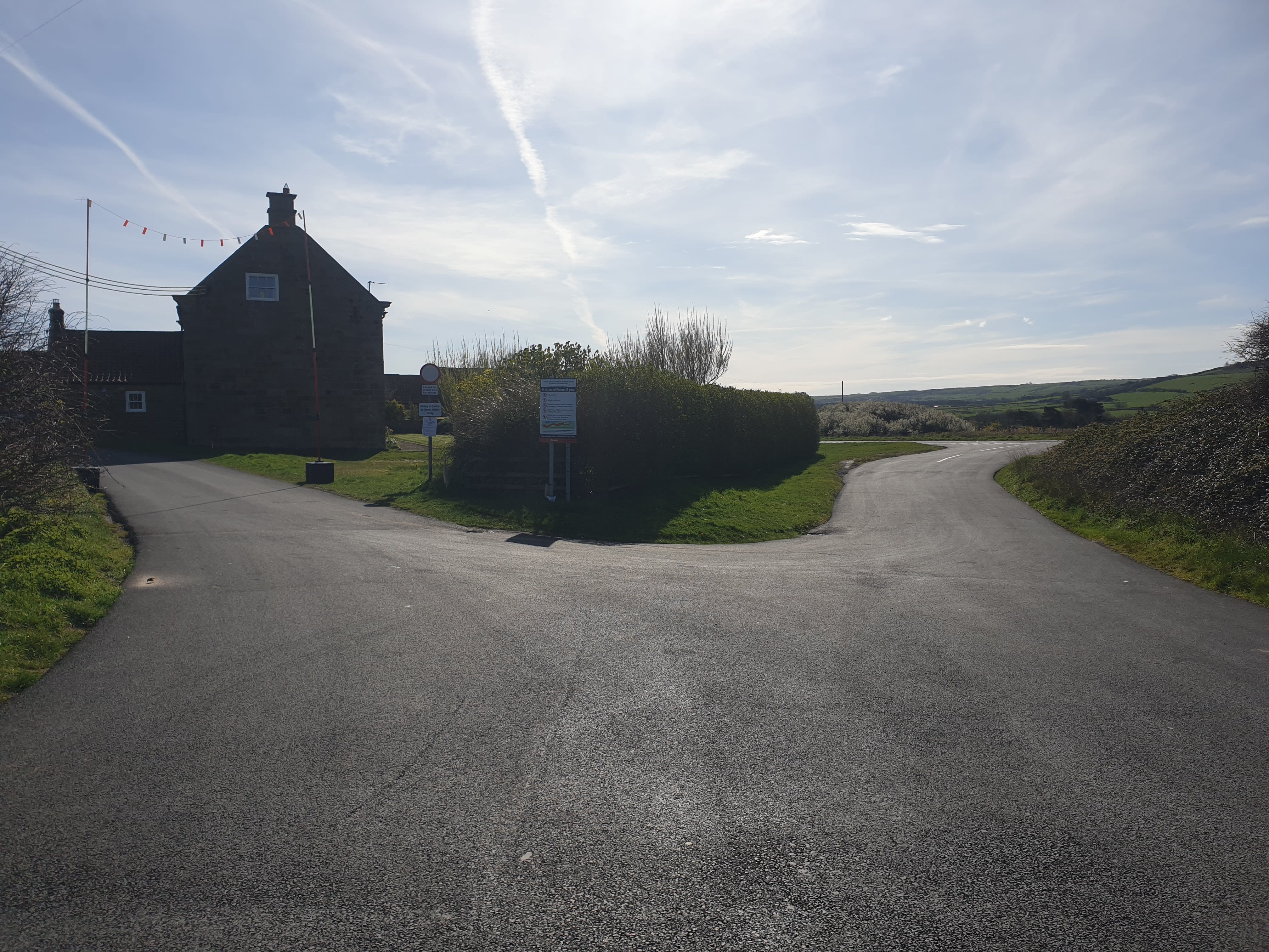
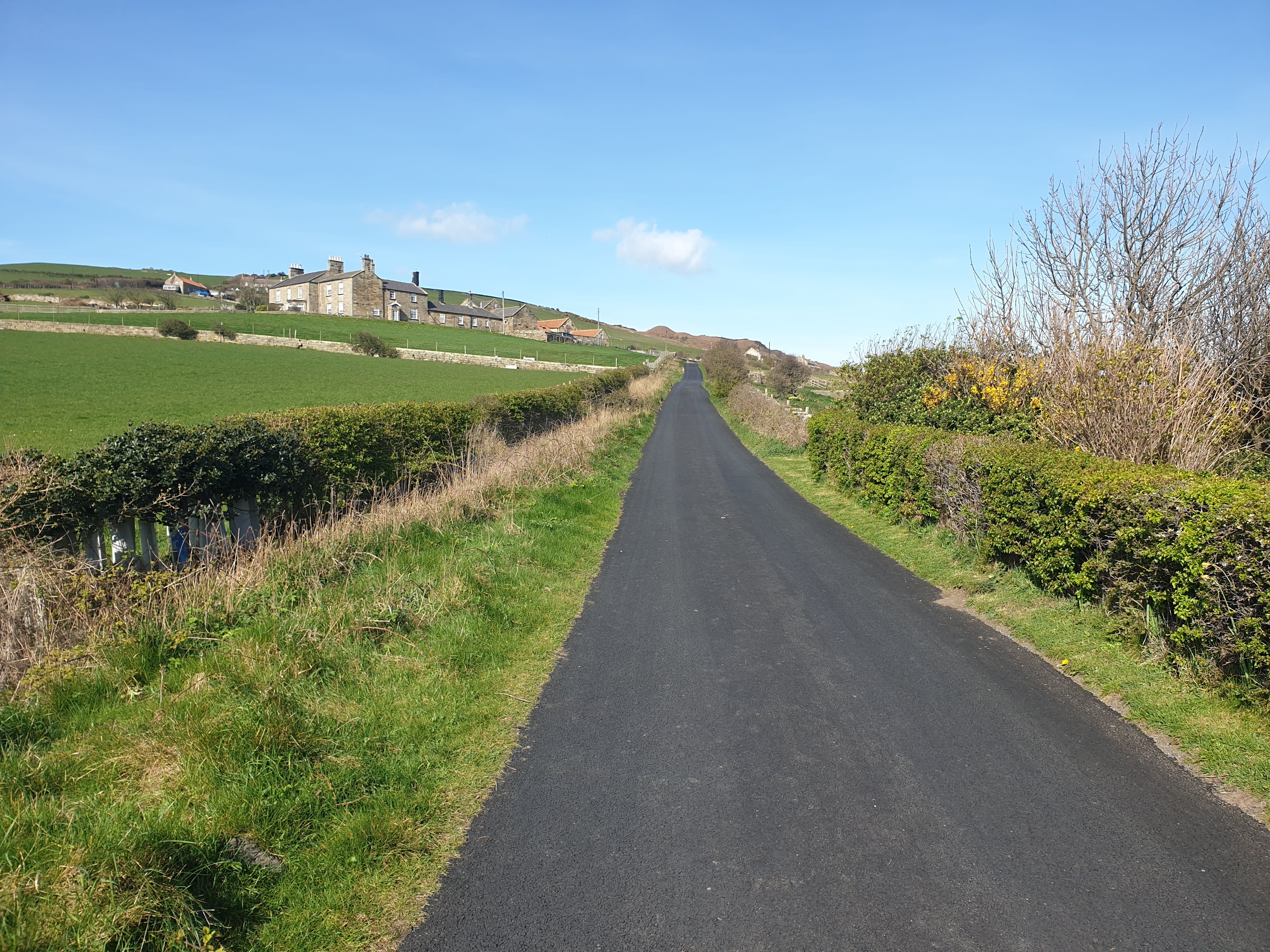
Head down the lane towards Red House Farm and take the road to the left, past the farm and north, towards the coast.
Just over the A174 by Cowbar Lane is Boulby Potash Mine. Located on the northeast coast of the North York Moors, the Boulby Mine is one of Europe’s deepest mines, primarily extracting polyhalite and rock salt through a massive network of tunnels that extend far beneath the North Sea. It reaches a maximum depth of 1,400 meters (4,600 feet), making it the deepest mine in Great Britain. The underground network is staggering, consisting of over 1,000 kilometers (620 miles) of tunnels. Many of these tunnels extend approximately 7 kilometers (4.3 miles) out from the coast, directly underneath the floor of the North Sea.
There are one or two further Tiggy Tours planned nearer the mine itself as there are some old mine workings nearby. For a bit more info on the mine, and an interesting map of the mine working routes under the sea click here: A Visit to a Renowned Polyhalite Mine: A Kilometre Beneath the Earth’s Surface.

Head off Cowbar Lane at this path on the left as the road bends right towards Cowbar.

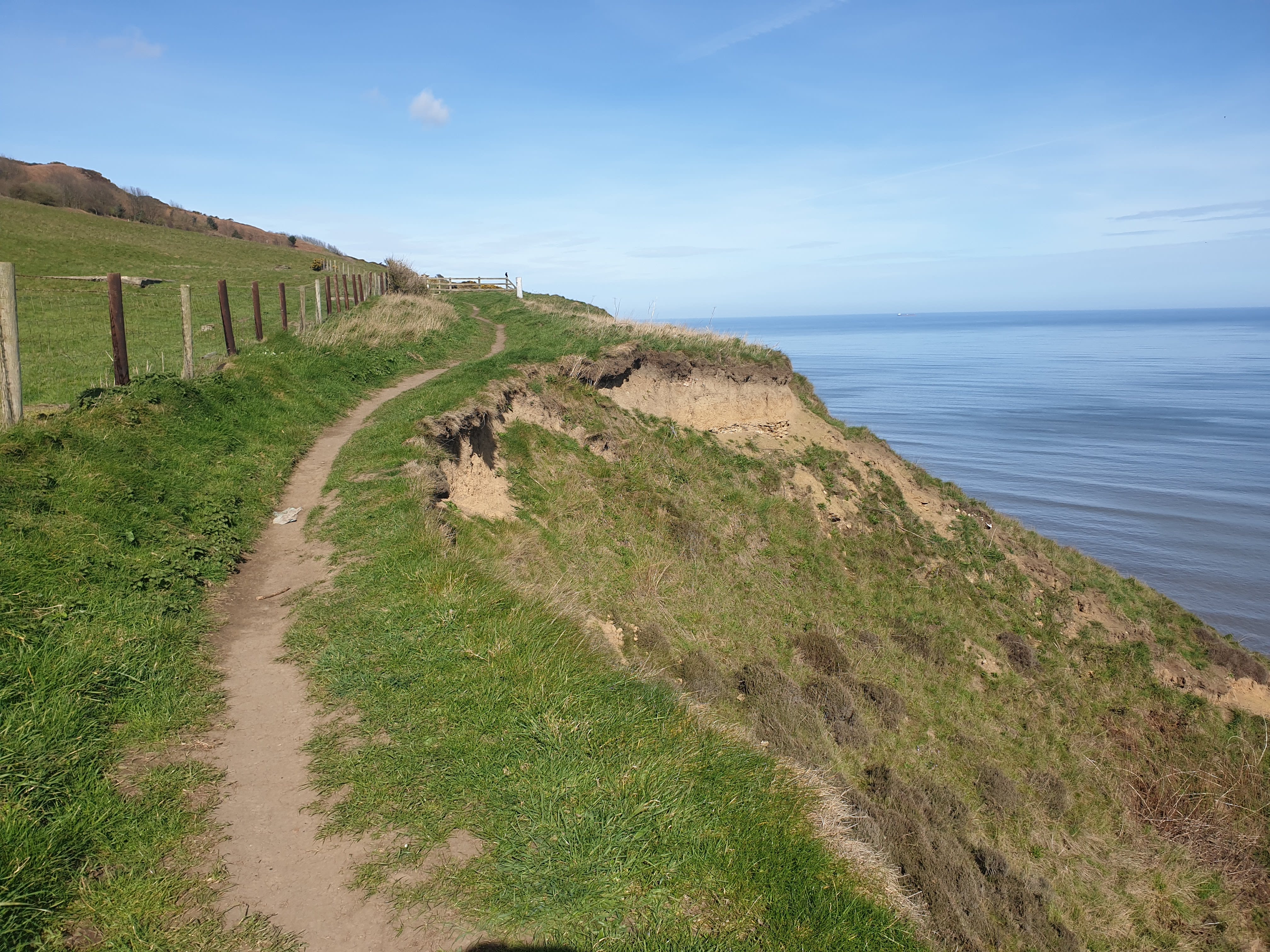
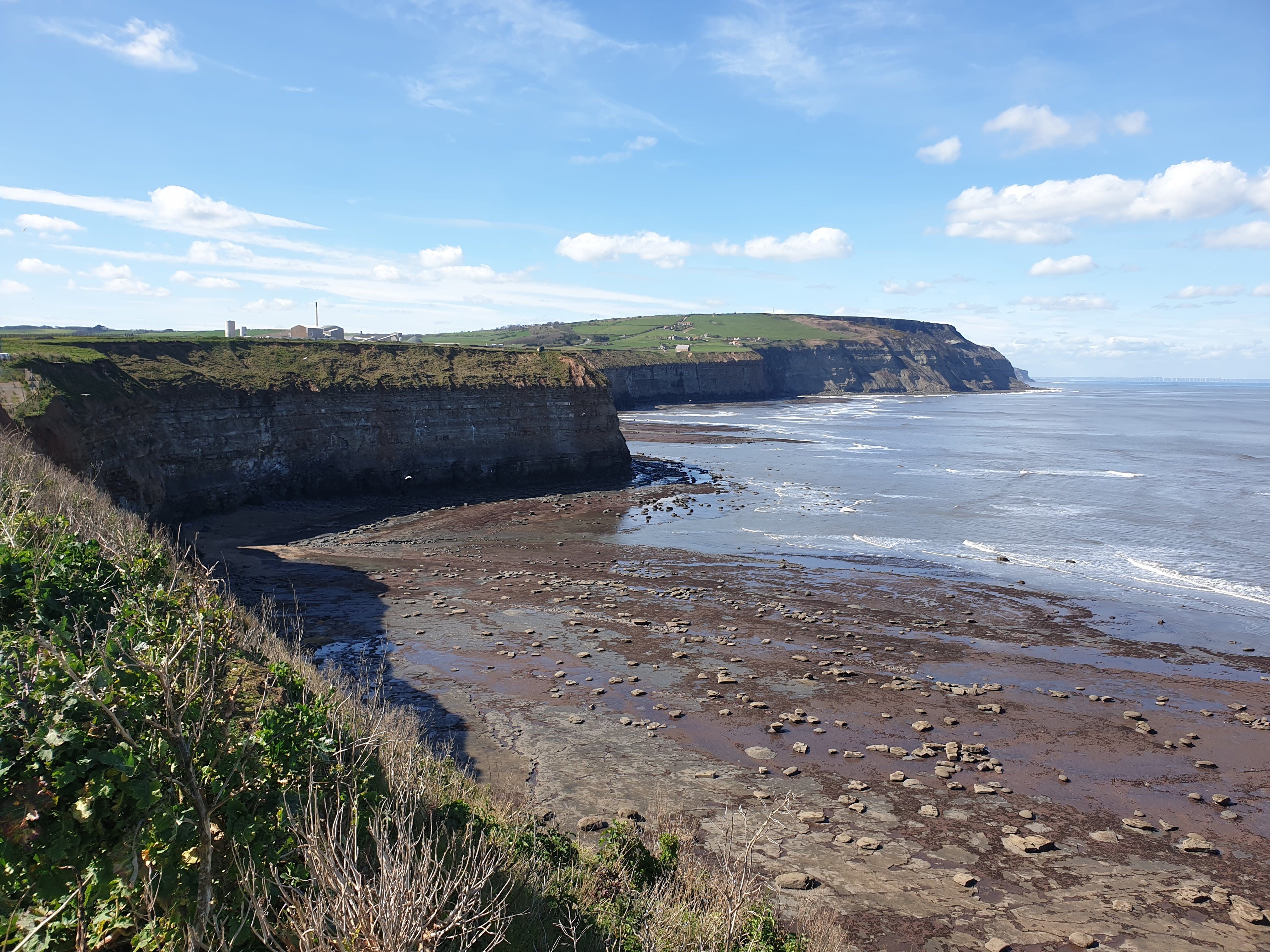
The path gets to the cliff edge at Redhouse Nab where, looking east, you can see down the coast to where this trek will finish at Cowbar Nab looking over Staithes.

After taking in the stunning views of the coast its time to head west, along the Cleveland Way, a grassy track at this point which turns to tarmac. This view shows the route ahead, turning right to the cliff edge after the buildings and then heading uphill, still along the Cleveland Way where the foliage is brown in this pic.

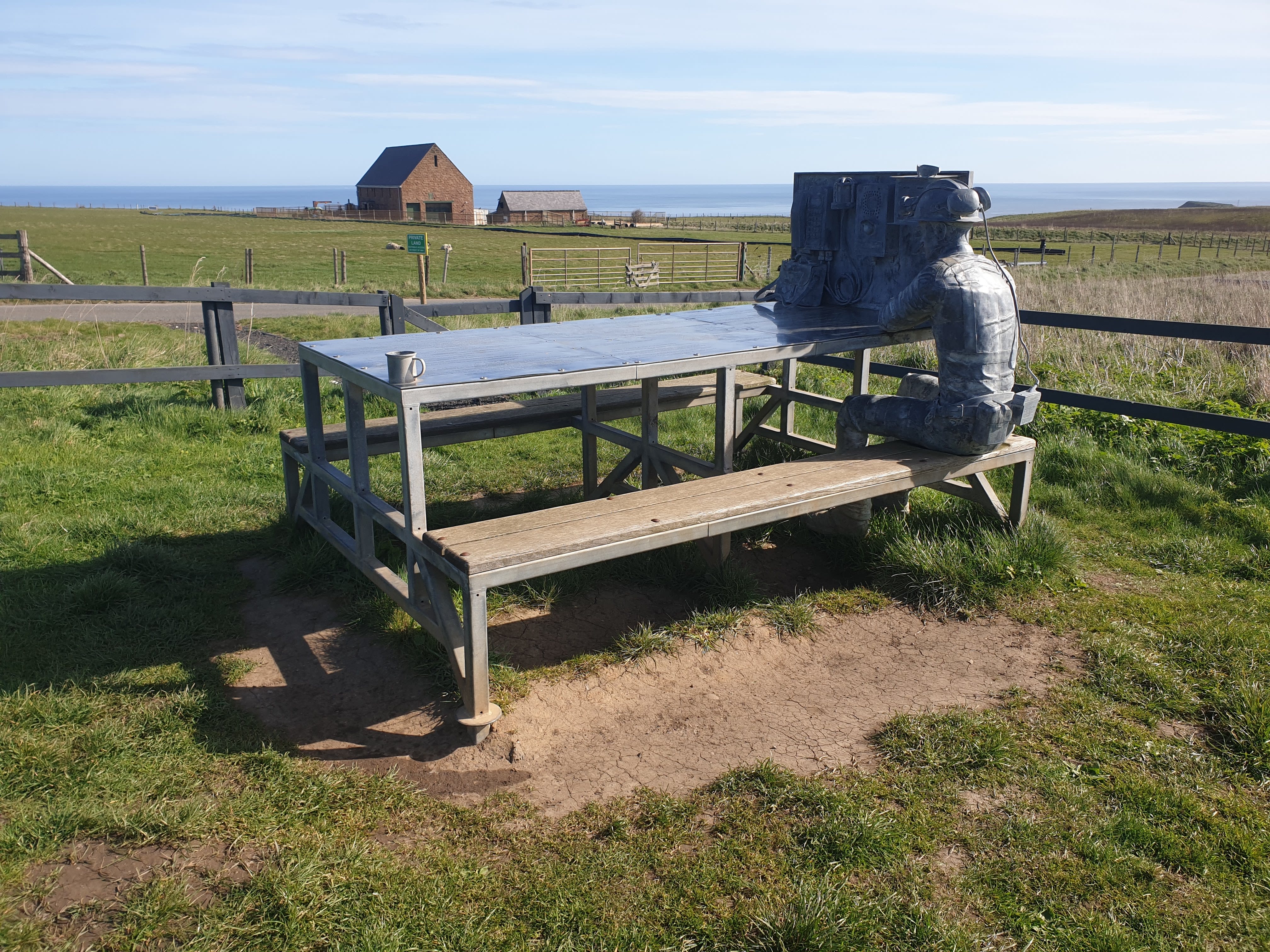
“The Miners Bait Table” Commissioned by ICL UK (the owners of Boulby Potash Mine) in 2020, to celebrate the mines history. A perfect picnic spot.
The grassy path turns to a freshly tarmac’d road, it’s a little uphill here as you head through the village of Boulby.
Just before Boulby village, looking back down the Cleveland Way and towards Cowbar and Staithes.

Continue past the few houses that are Boulby village and the path then gets much closer to the cliff edge.
Another look back along the coast to Cowbar and beyond.

The path continues along the cliff edge with a wire fence on the left. Follow this fence line as the path turns left, uphill, and inland for a short while.

Yet another look back at the route taken so far. The slight view of a bay on the horizon in the middle of this pic is Runswick Bay.

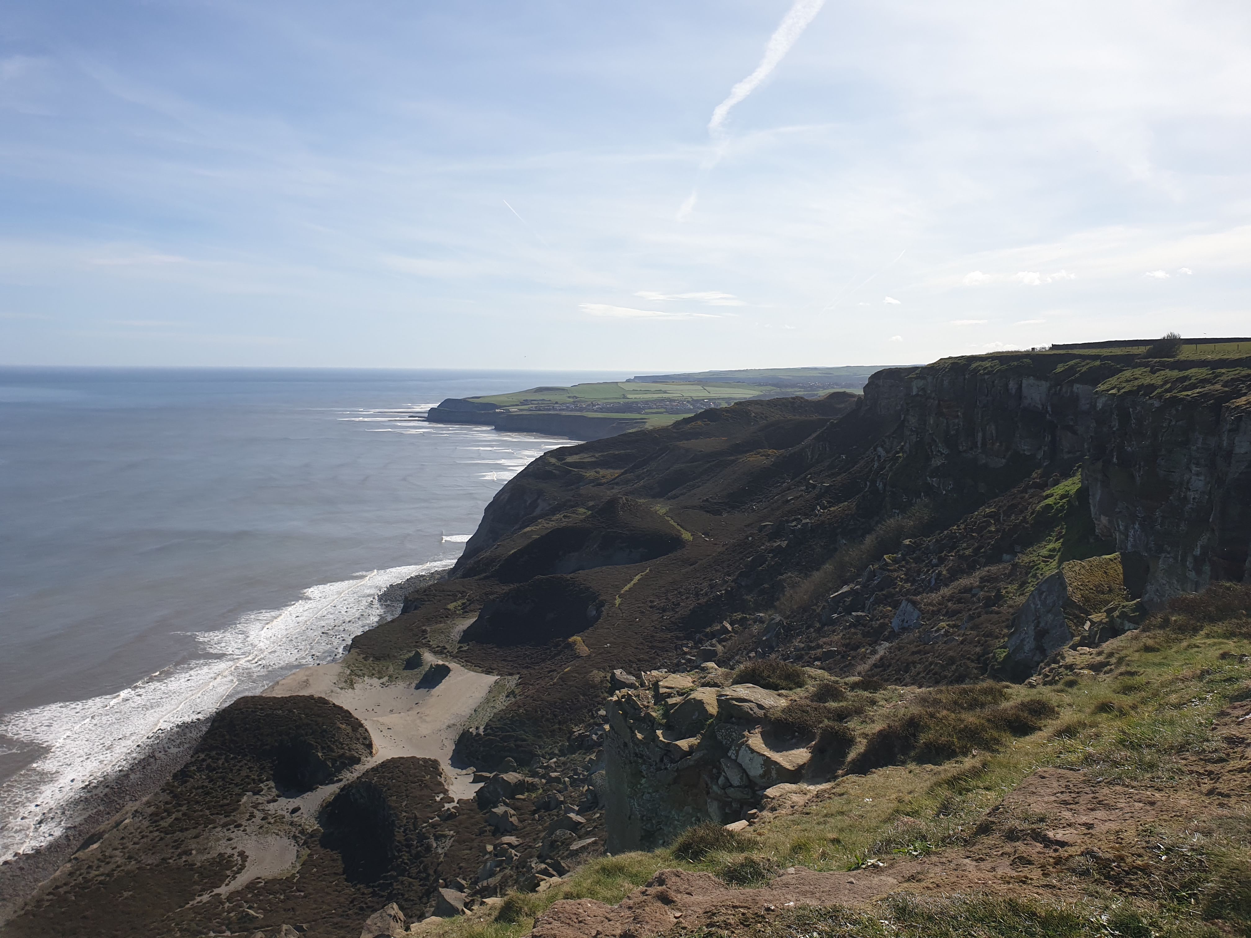
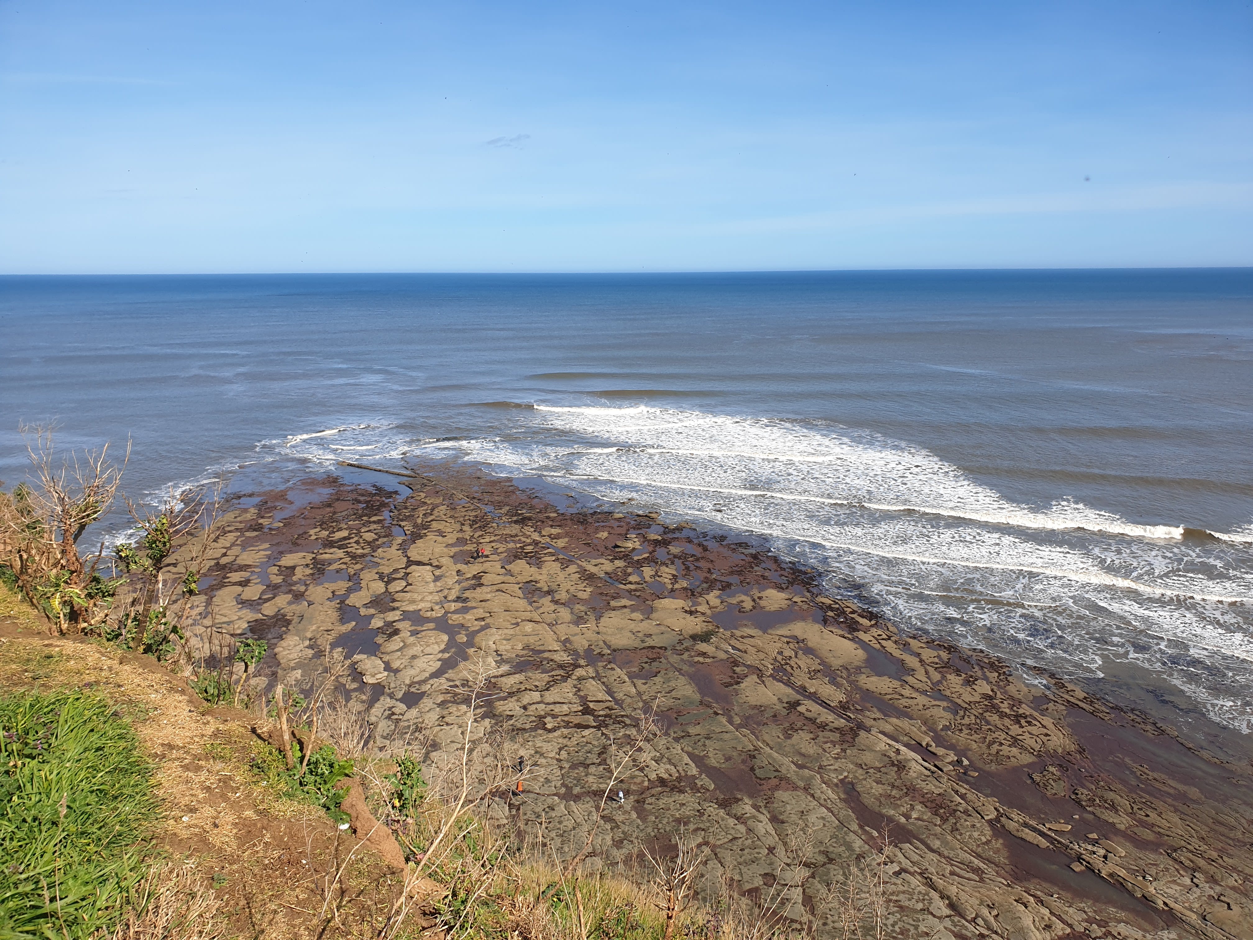
As you get to the top of Rockhole Hill, its back to the cliff edge. Here, a view of a very calm North Sea and some old quarry workings below.

The path continues along the clifftop.

Most of the pics I took were of cliffs, so here’s something a bit different, the North Sea and the small speck in the middle, a fishing boat.

Back to pictures of the cliffs again, looking back yet again towards our final destination, Cowbar Nab.
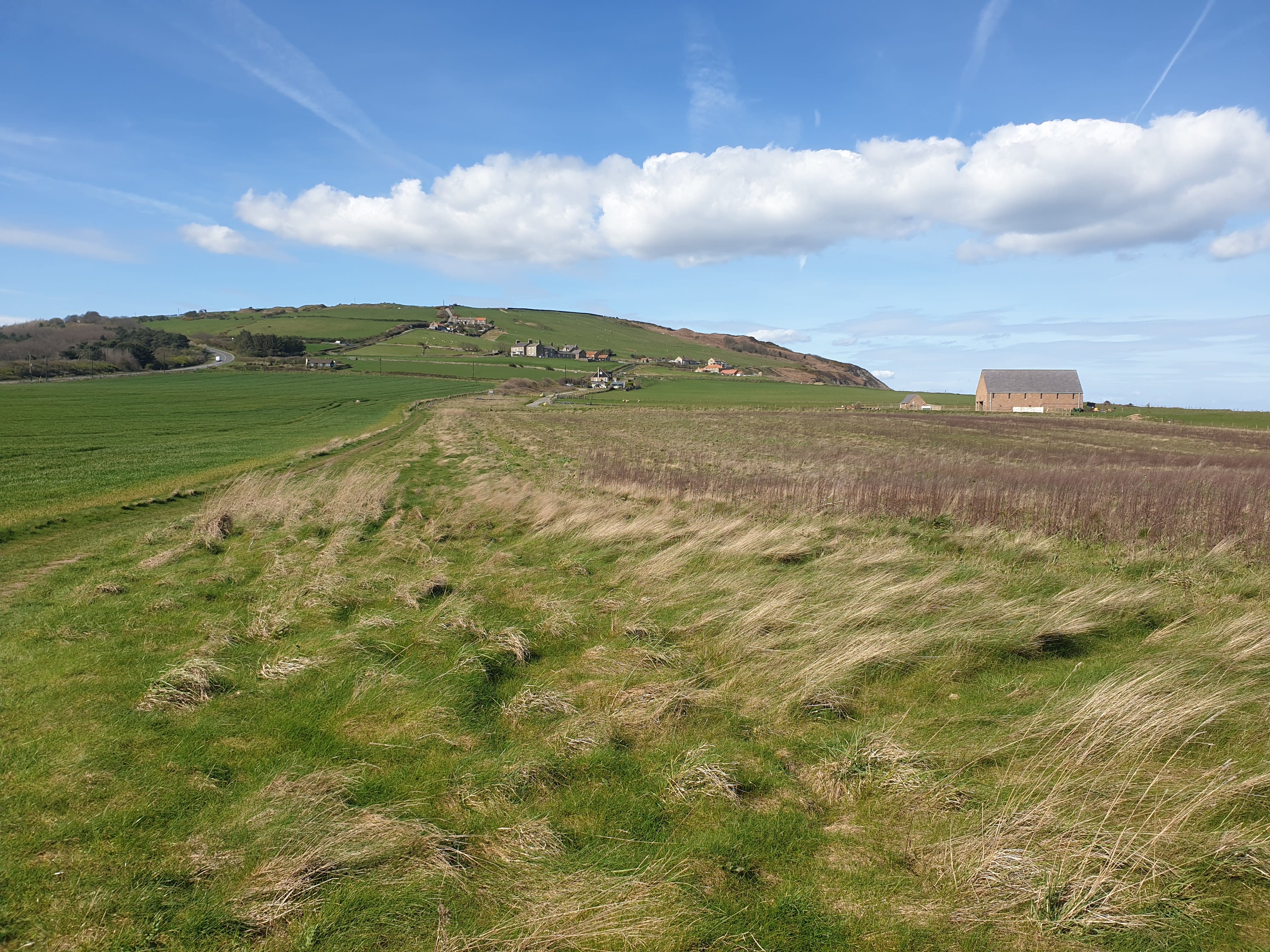
Since most of the pics are of the coastline, here’s one of the fields inland.

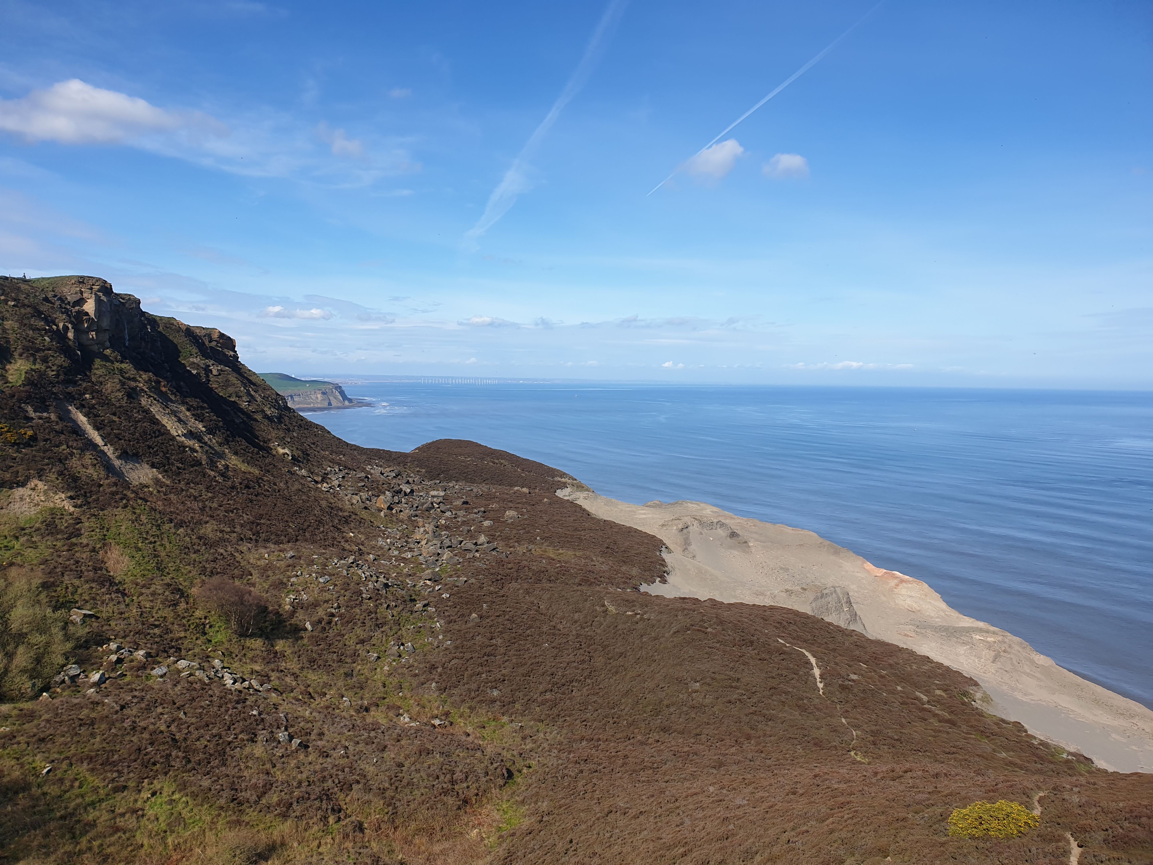
Nearing the end of the westerly route with the windfarm off Redcar coast appearing in the far distance.

The lower ground in this pic is the final part of the Skinningrove to Mars trek, the turning about point of this hike.

And here looking down the cliff, this is a footpath, which is part of the Skinningrove to Mars hike as that route heads up onto the cliff top. It’s a steep path! Todays route doesn’t take us down there.

A look down the route of the previous hike, a place named as The Warren on OS Maps. With the footpath on the bottom right of the pic being part of that previous Skinningrove to Mars hike.
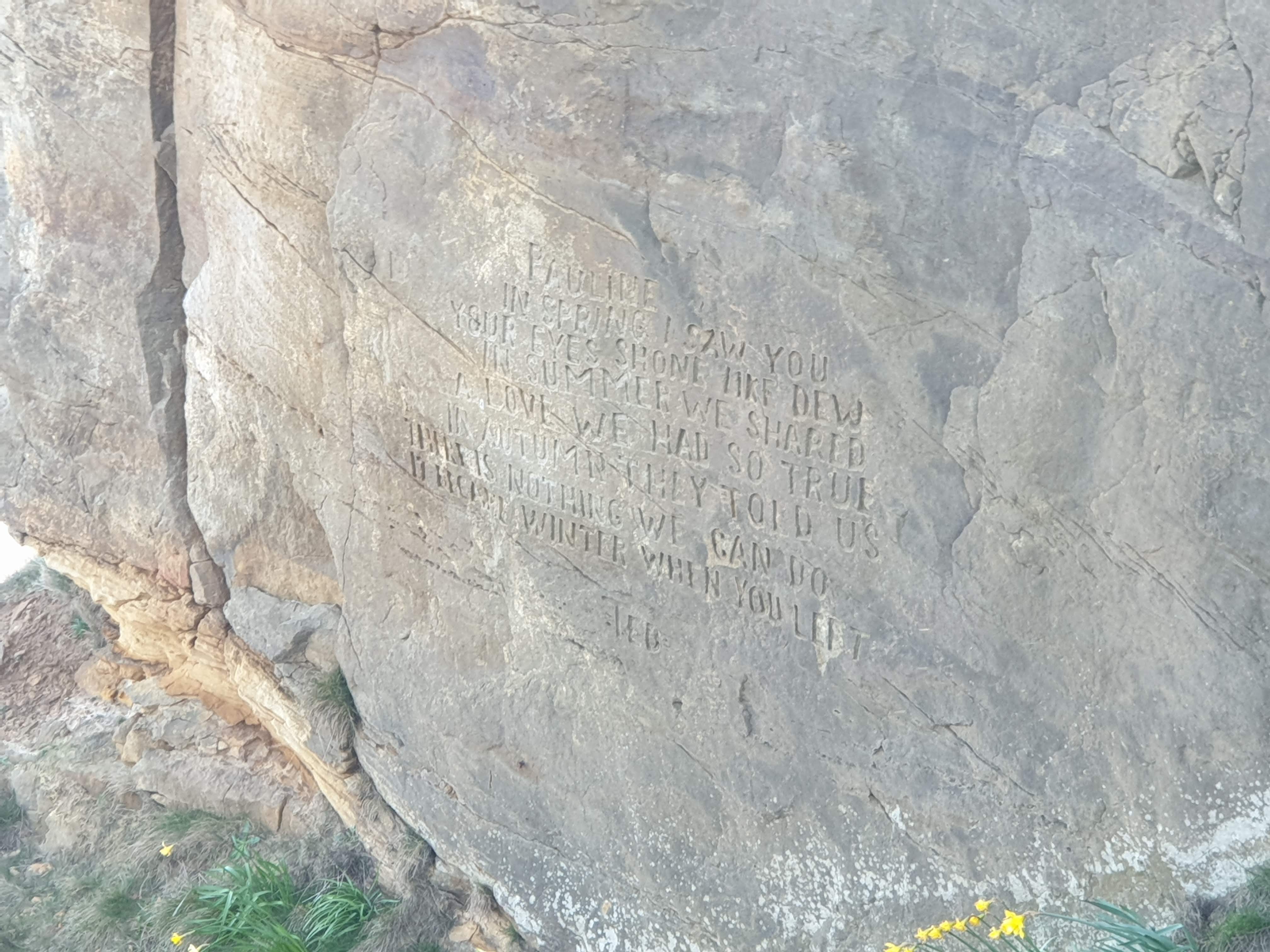
At this point we turn about heading back along the Cleveland Way, following exactly the same path. Heading in the easterly direction reveals this cliff, where, if you look closely, there’s an engraving.

More about the engraving is in this Teesside Live article: Man chiselled his words of love into cliff face after his world ‘fell apart’.
“PAULINE. IN SPRING I SAW YOU YOUR EYES SHONE LIKE DEW. IN SUMMER WE SHARED A LOVE WE HAD SO TRUE. IN AUTUMN THEY TOLD US THERE IS NOTHING WE CAN DO. IT BECAME WINTER WHEN YOU LEFT. TED”
The view from the top of the cliff just above the engraving, with Skinningrove headland in the distance.

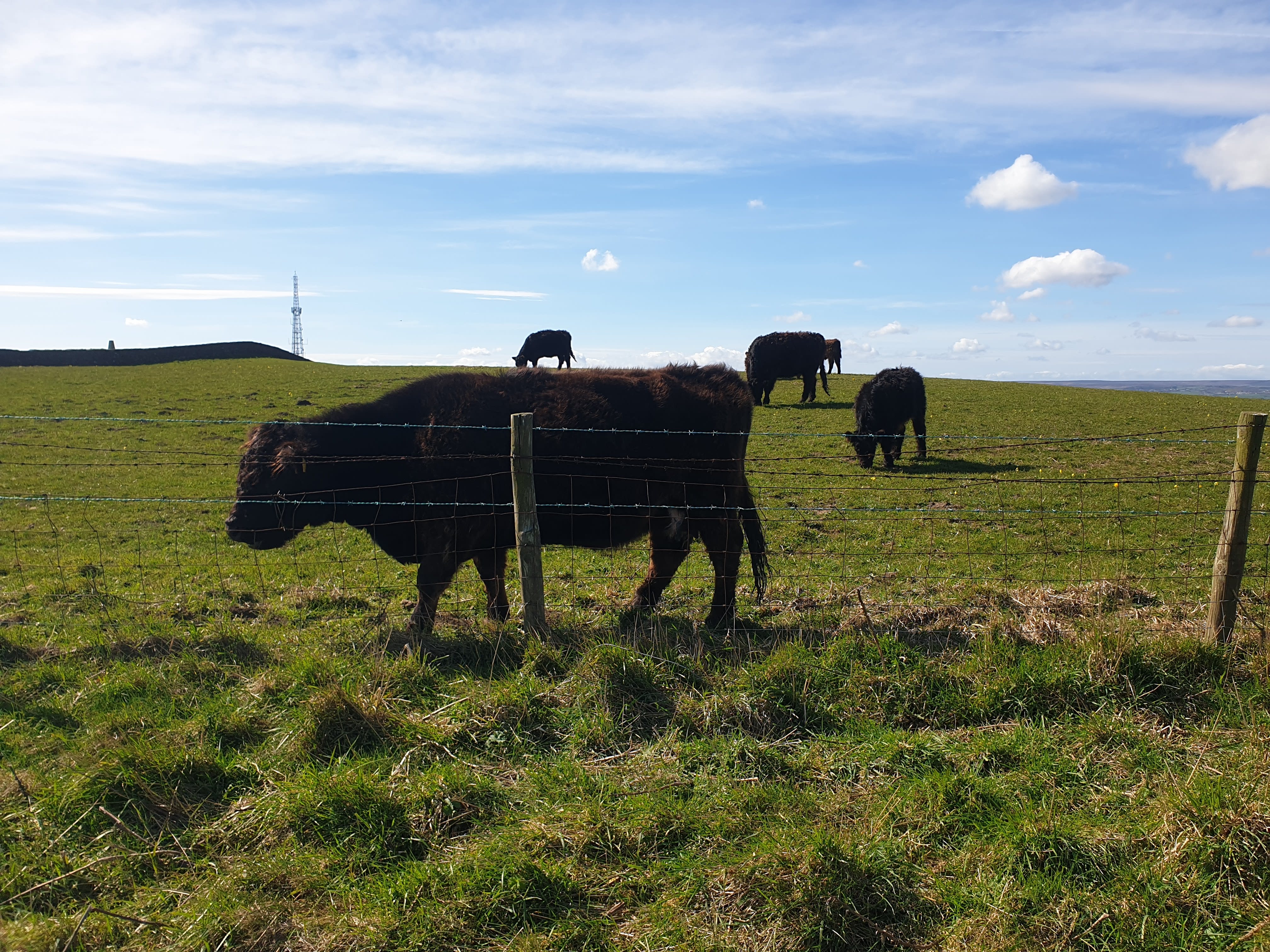
The one and only animal pic of this tour of some cows near Rockcliffe Farm.
The next half of the tour is heading back along the same route as before. So the same distance as already completed but now covered in one sentence.
Back to Redhouse Nab, a short walk from the parking spot, looking back at where we’ve been, Boulby and beyond.
Now the final, short part of the trek, to Cowbar Nab along the Cleveland Way heading east.

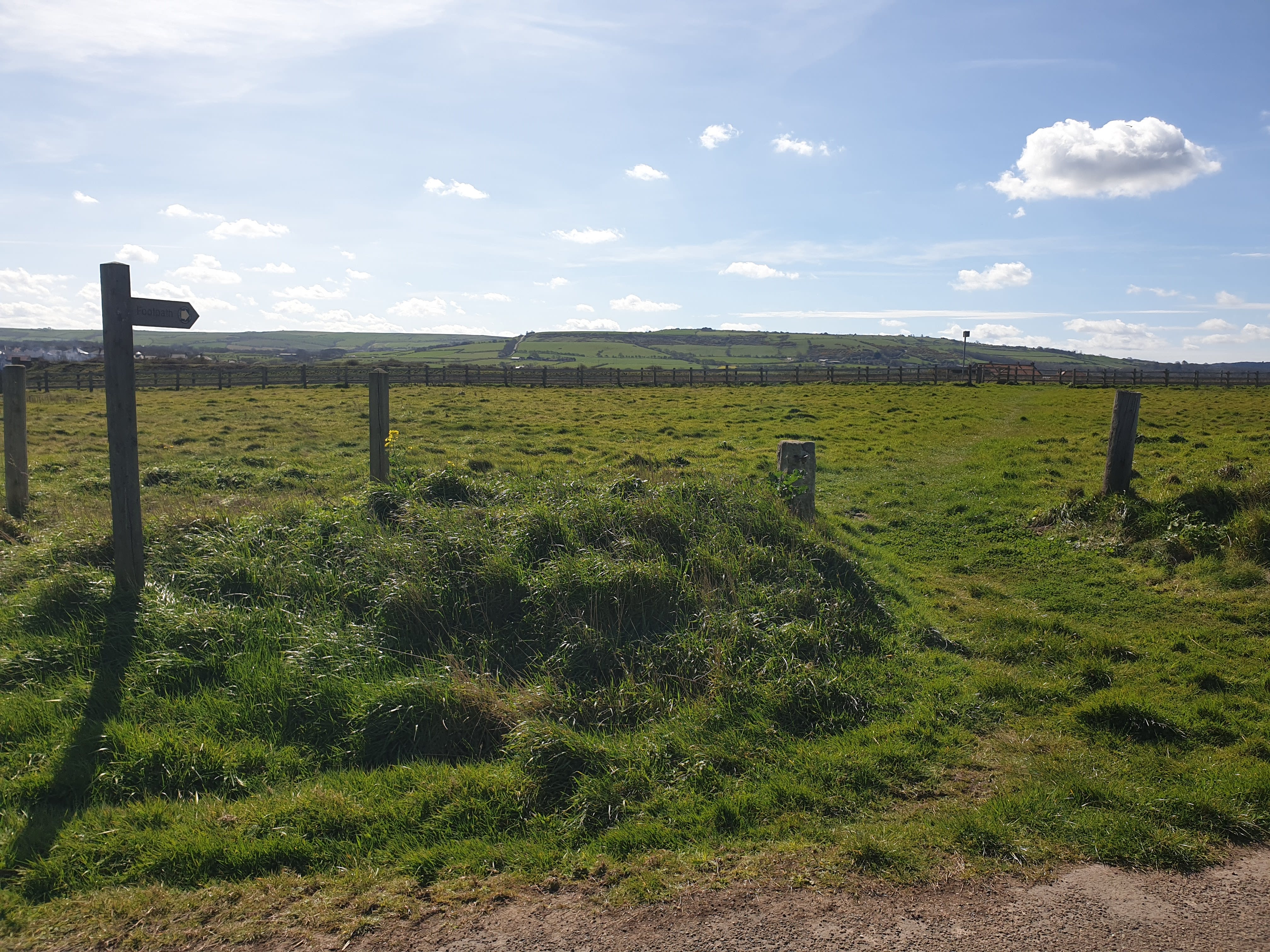
The footpath runs parallel to Cowbar Lane with the lane on the right and the cliff edge on the left. As you approach Cowbar there is this signpost pointing inland across a field, this is part of the Runswick Bay to Staithes hike.
Another look back at where we’ve been previously, the cliffs and Boulby mine.

Approaching Cowbar the Cleveland Way joins the road and heads left and downhill past the terraced houses that make up Cowbar.

One final look back up the coast.
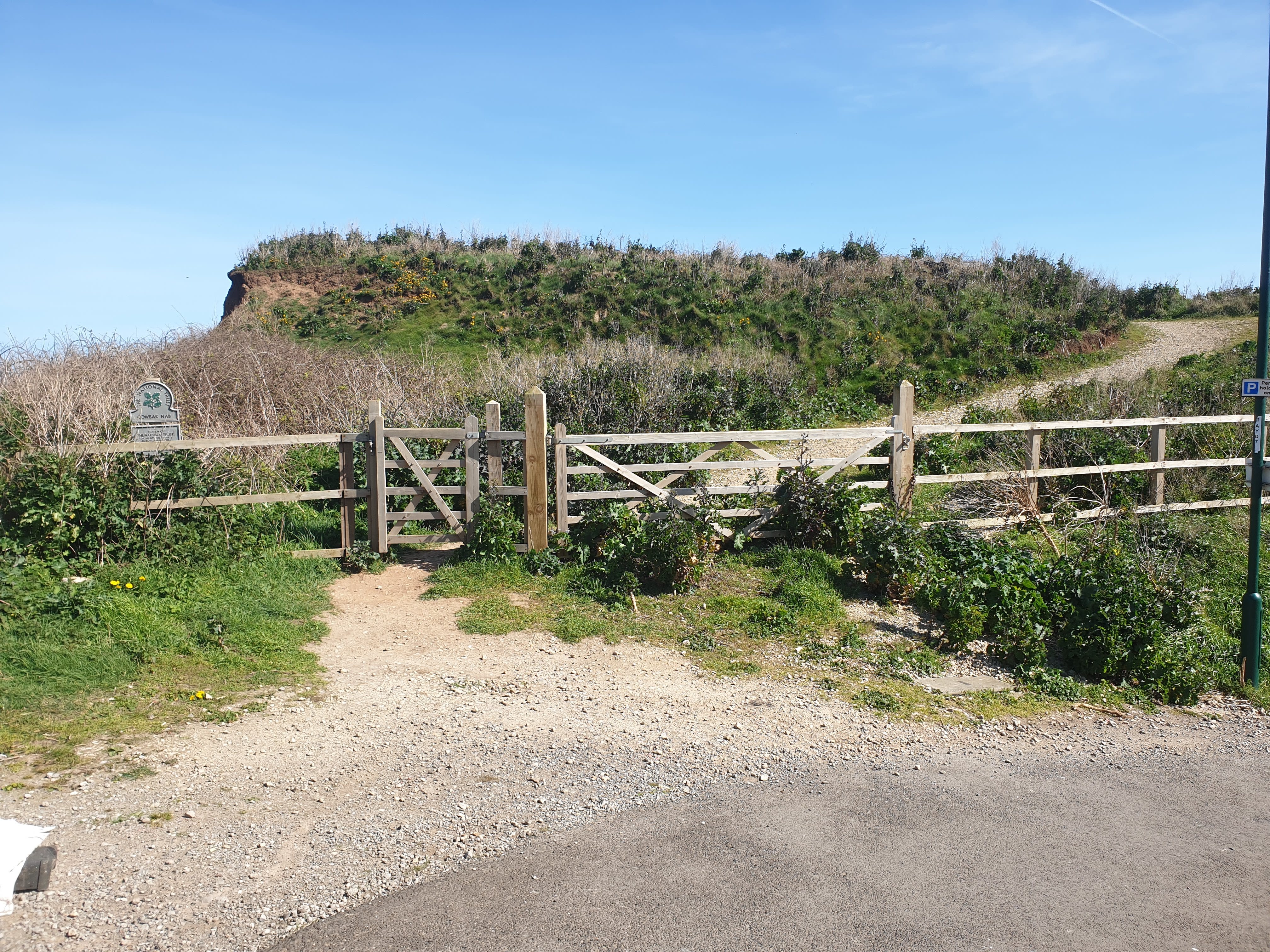
As the road bends right there is this gate with a small National Trust sign “Cowbar Nab”. Go through this gate and follow the gravel track.
The path then turns to a dirt path with a lot of vegetation either side. At this time of year, early April, it was easy to spot but I imagine it will get a little overgrown in the summer months.

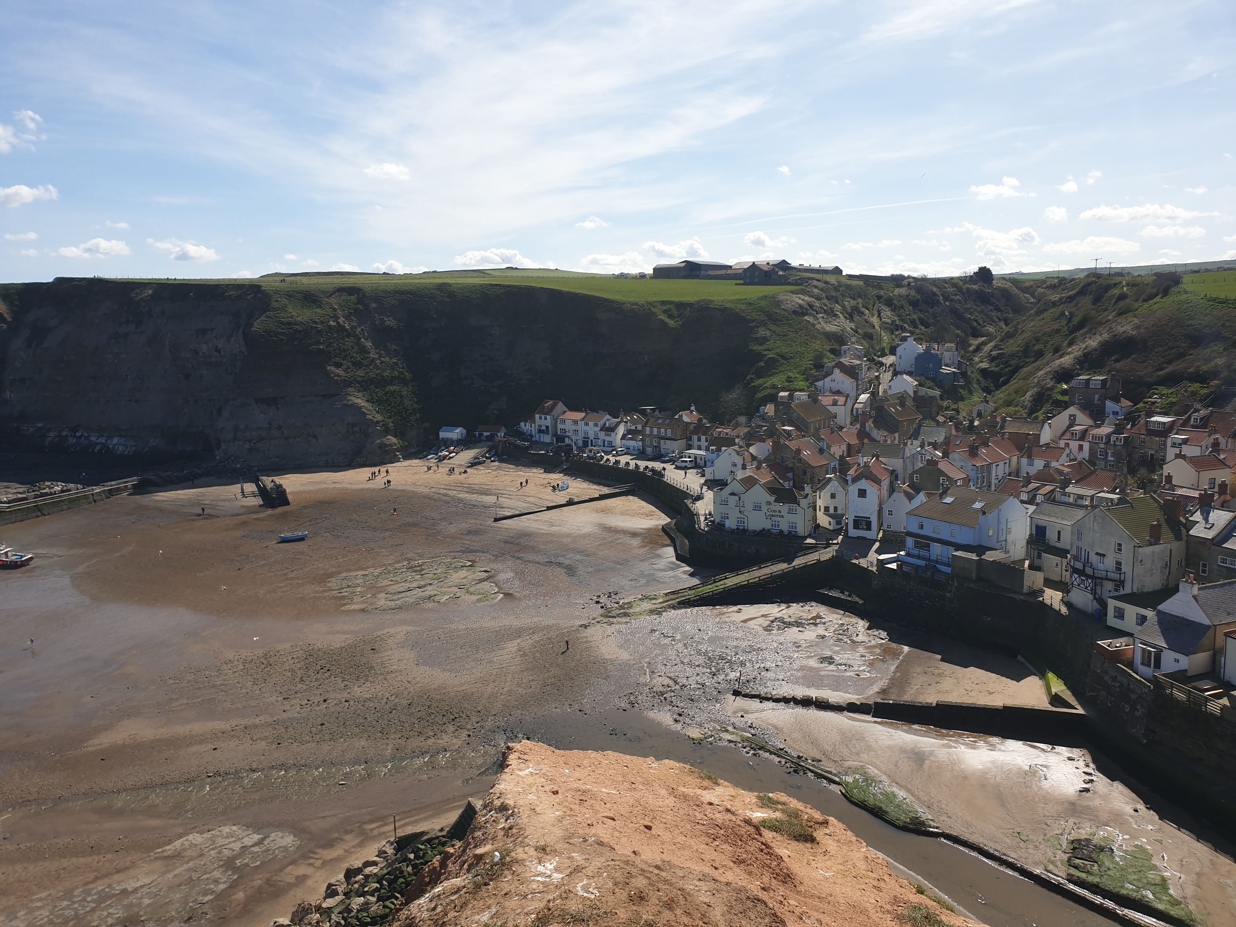
Head along the path to the edge of Cowbar Nab being very careful near the edge, it’s quite a drop. The final six pics below are all from the Nab looking over Staithes Harbour and around to the right over Staithes.


After taking in the views its time to head back, along the path from Cowbar Nab, along the road, uphill past Cowbar and further along Cowbar Lane to the parking spot.