I’ve done Semer Water a few times, with family and friends, this time I planned a nice big loop around the water. I visited a few weeks previous to this walk where mam and I parked at Stalling Busk and walked down to the ruins of a chruch and was told of a family grave. So I thought I’d do this trip and try to find the old family grave.
This is the route I took, parking right by the shoreline here, then travelling in an anti-clockwise loop and getting the steep uphill part done straight away. It’s then a case of following the top of the hill for a mile or so then turning left and heading downhill through fields to Marsett. A stony track from Marsett to more fields under Stalling Busk, northeast back to the parking spot by Semer Water.


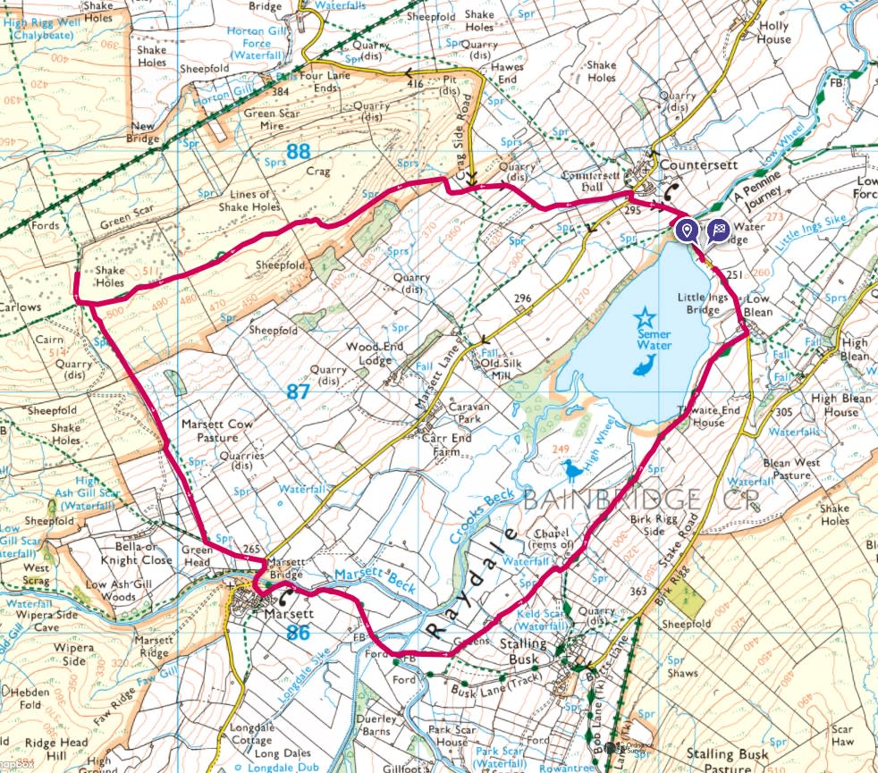
It’s great to park right by the shoreline here, and makes for a good photo. The ducks thought I was quackers for parking so close to the waters edge.
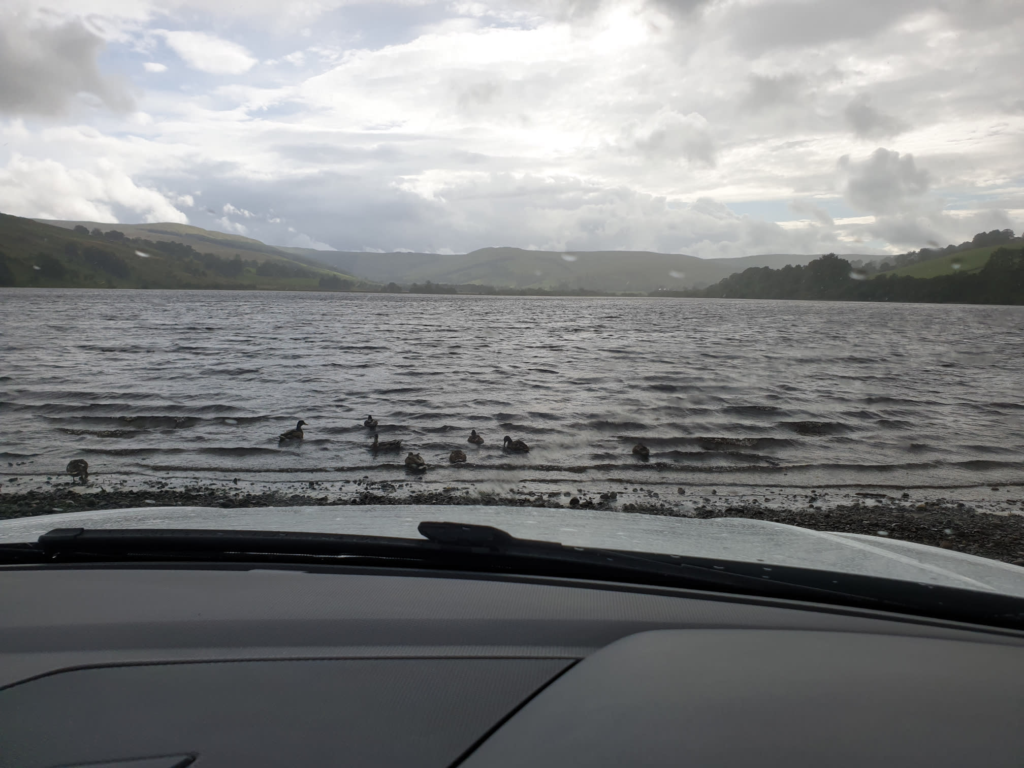
On the day of this Tiggy Tour it was a bit busy when I got to Semer Water and the parking spots by the water were all taken. So I left Tiggy by the side of the road and the water and headed northwest along the road towards Countersett.
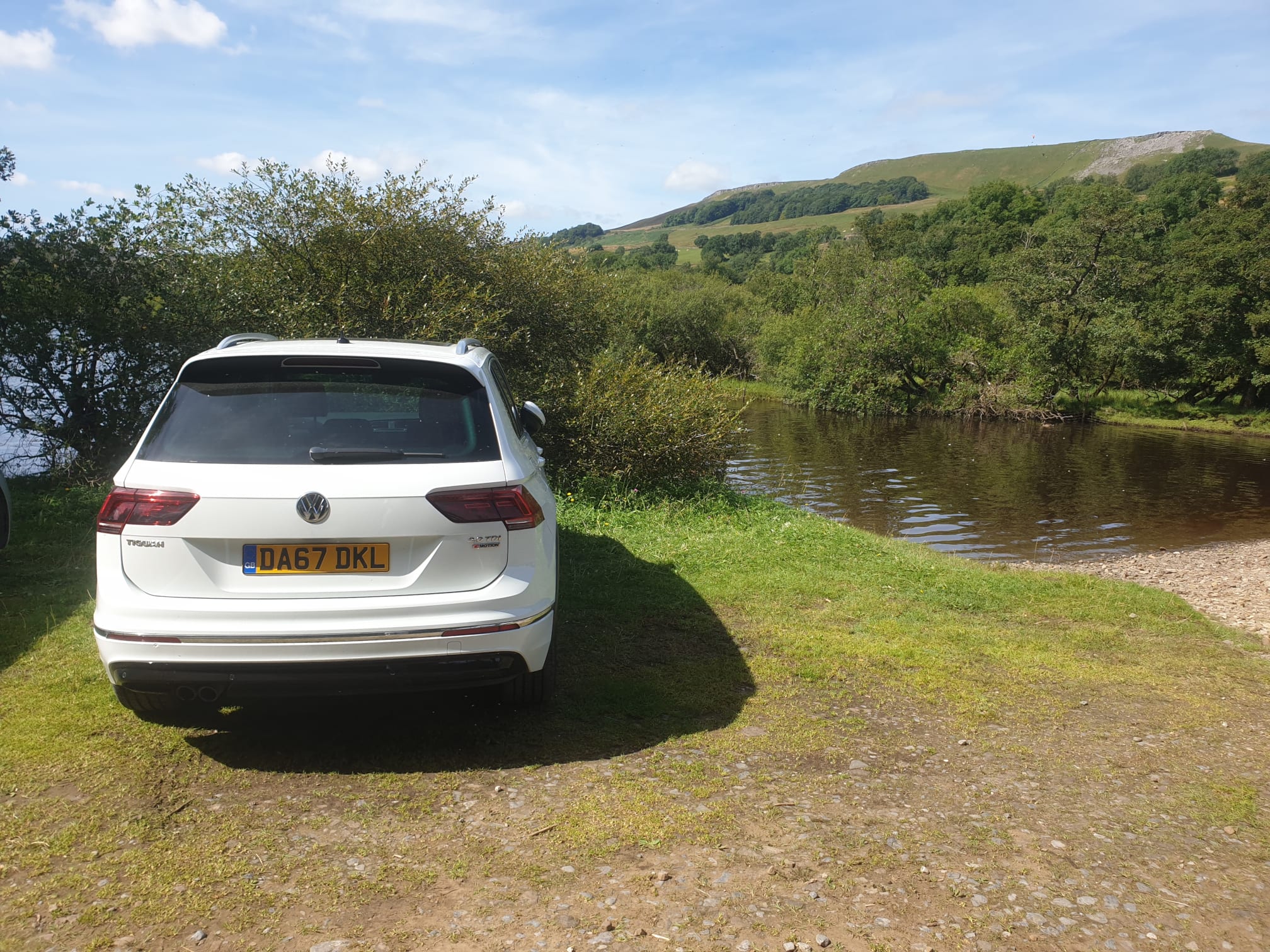
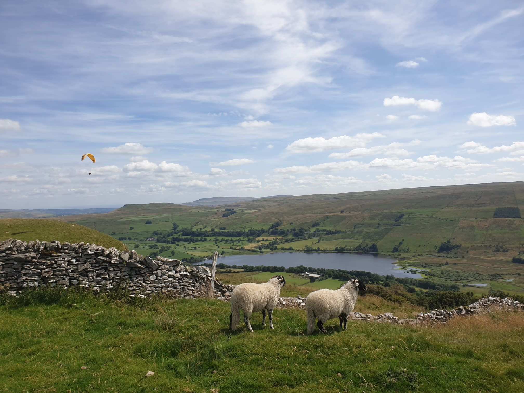
The first mile or so consists of a steady uphill, following the road at first, past Countersett (not through it) and continue along Crag Side Road. At a particularly steep and tight bend to the right leave the road on the left onto grassy paths through fields and up to the top of Wether Fell. The hard work is worth it with a great view of Semer Water and Raydale below.
It was here where I met a couple of locals…
But they were more interested in the view, and the paraglider.
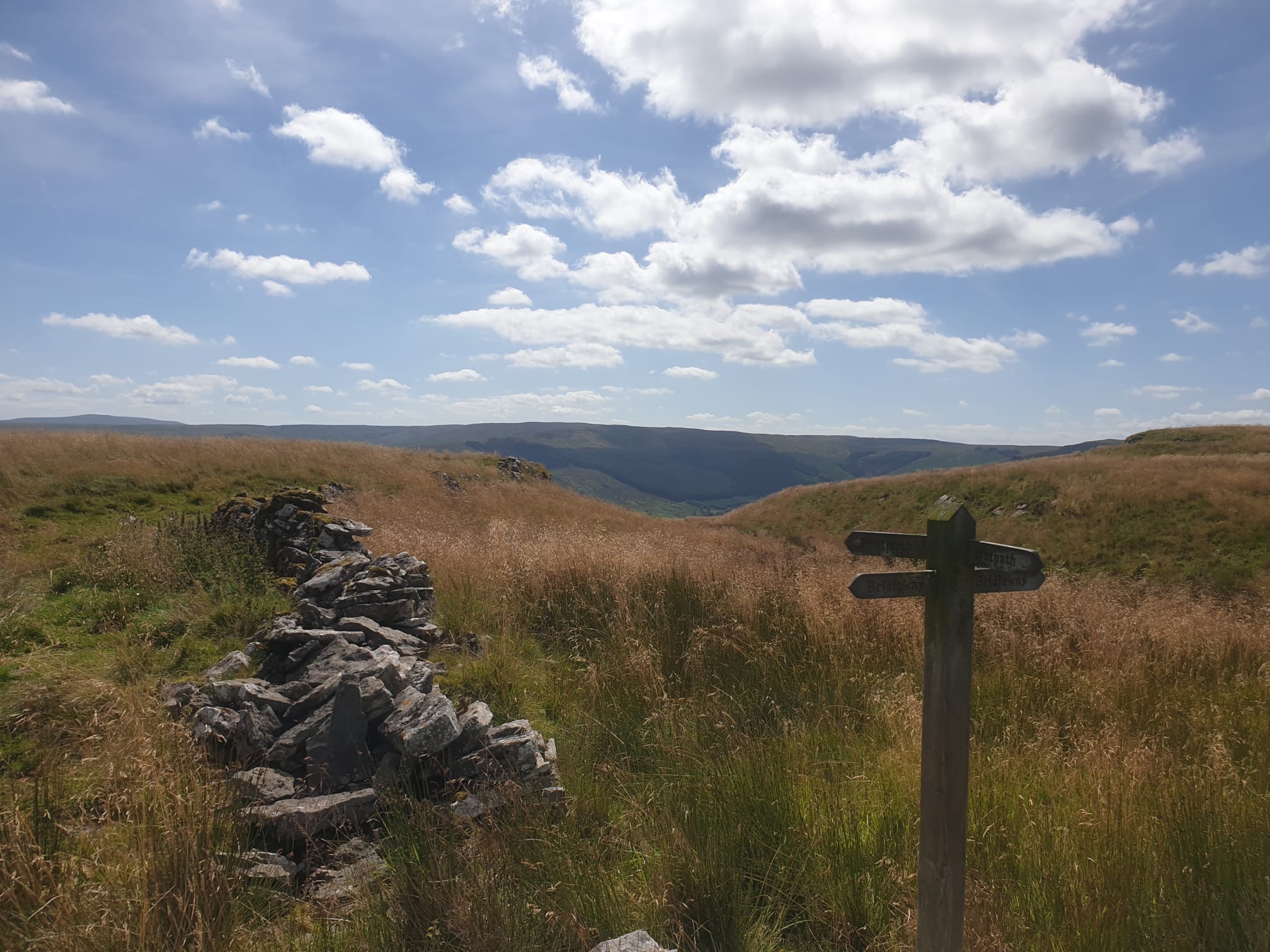
After hiking along the top of the hill its time to turn left downhill towards Marsett but I took a little detour, heading north just for a short distance to see over the hill where Hawes lies.
I then turned around and headed back in the direction of Semer Water. A nice downhill walk through fields down to the village of Marsett.
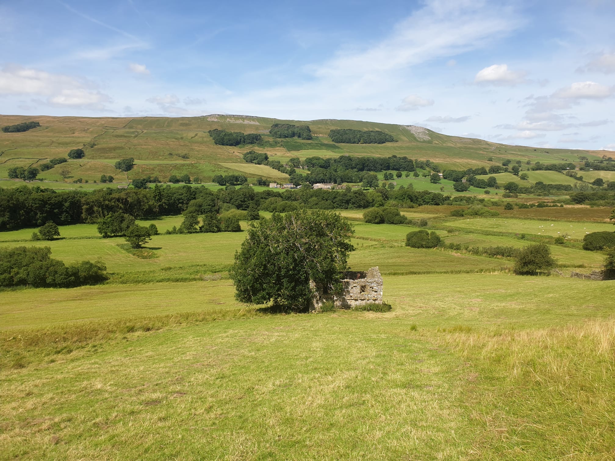
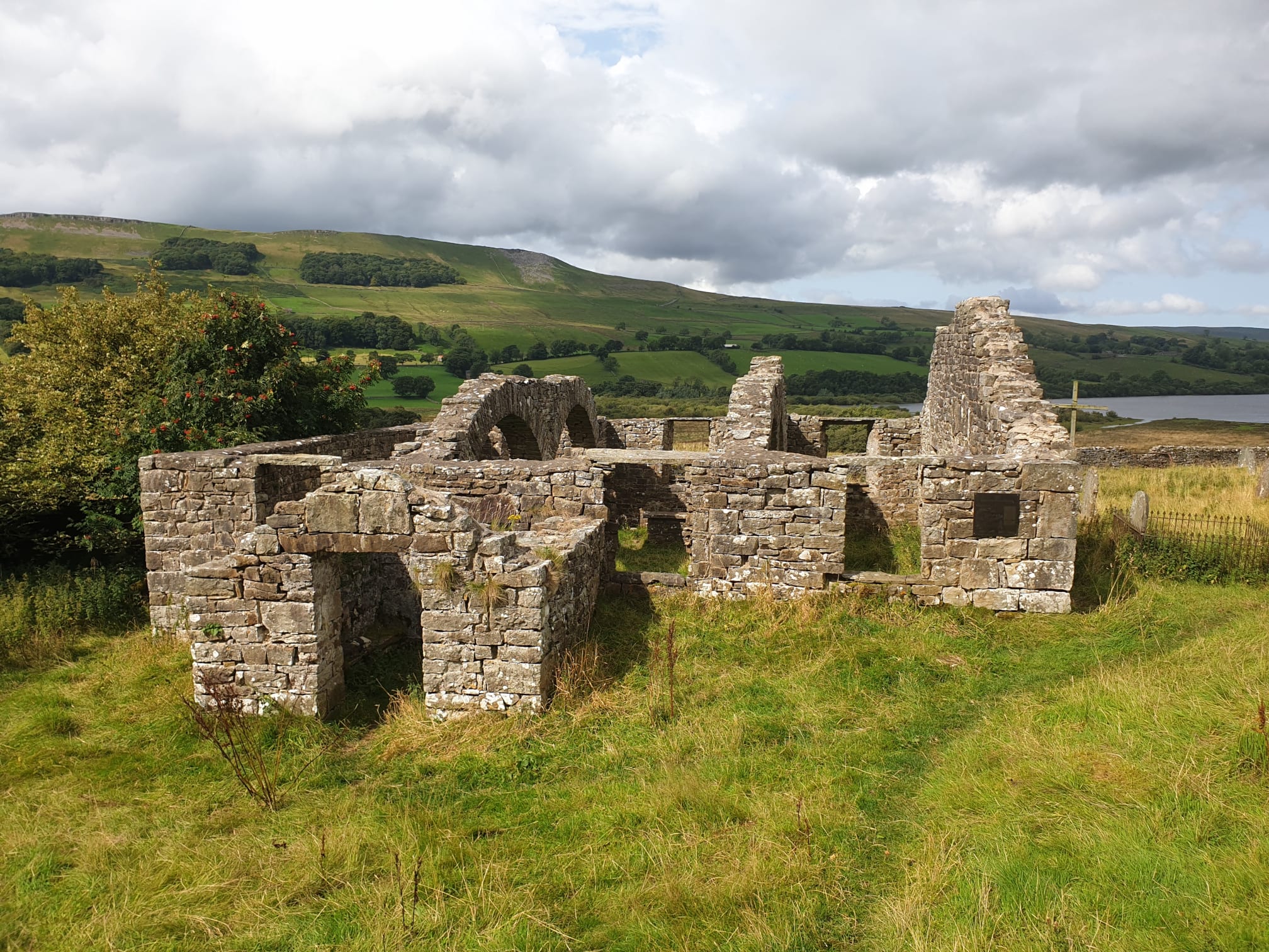
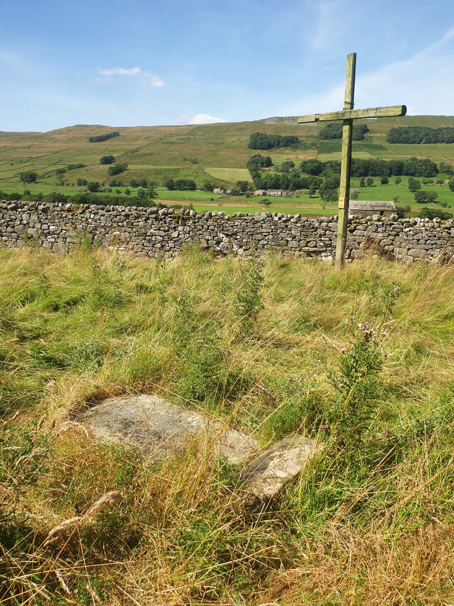
Crossing Marsett Bridge and passing by Marsett, following a stony track along the bottom of the valley, by the side of Marsett Beck. Then a bit of an uphill towards Stalling Busk but turning left a field before you get to the village. It is here where the church ruins are along with nice views back across the valley of the route taken at the start of the hike.
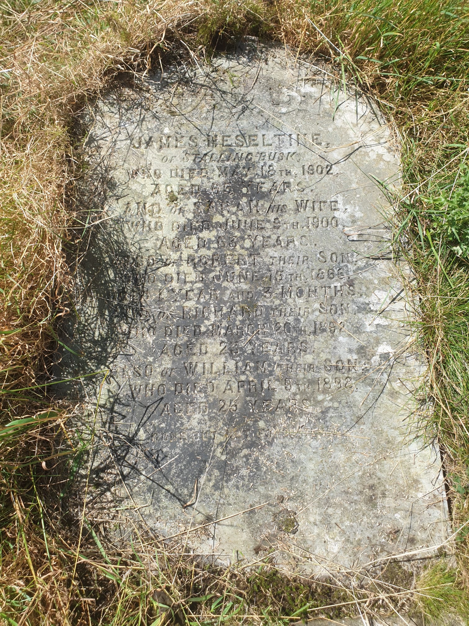
A bit of research before my trip had shown the grave did exist with the name James Heseltine at the top of the gravestone. Thanks to findagrave.com. In the photo below, the gravestone is upright but the previous trip had shown this wasn’t the case, there were very few upright gravestones.
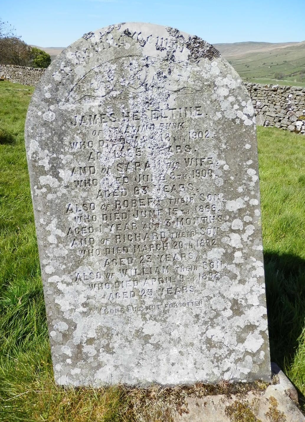
It was here, in the overgrown ruins of the churchyard that I went grave digging, well, grave scraping. Clearing the grass off a few gravestones using the findagrave.com image and stones on the drystone wall behind as reference points. Then, I saw the surname Heseltine…I’d found the family grave!
After a successful gravestone hunt and a picnic it was time to finish the hike.
Leaving the church ruins and heading northeast, the final bit of the hike is quite straight and level as you head along the bottom of the valley near the southern bank of Semer Water. I kept to the path but others do head along the shoreline of Semer Water. The path then leads to the road at Low Blean, turn left and then follow the road north back to the parking spot.